On a clear morning from the cliffs above Jerbourg Point, you can see France. Not as an idea — as a low green line across fourteen miles of water, close enough that the Normandy coast looks like the next headland over. The Channel Islands sit in that strange piece of sea between Britain and France, closer to Saint-Malo than to Southampton, but constitutionally tied to the British Crown since the eleventh century. They aren’t part of the UK. They aren’t part of the EU. They have their own parliaments, their own currencies, and, on Jersey at least, their own language — Jèrriais — still spoken by a few hundred people who grew up with it at the kitchen table.
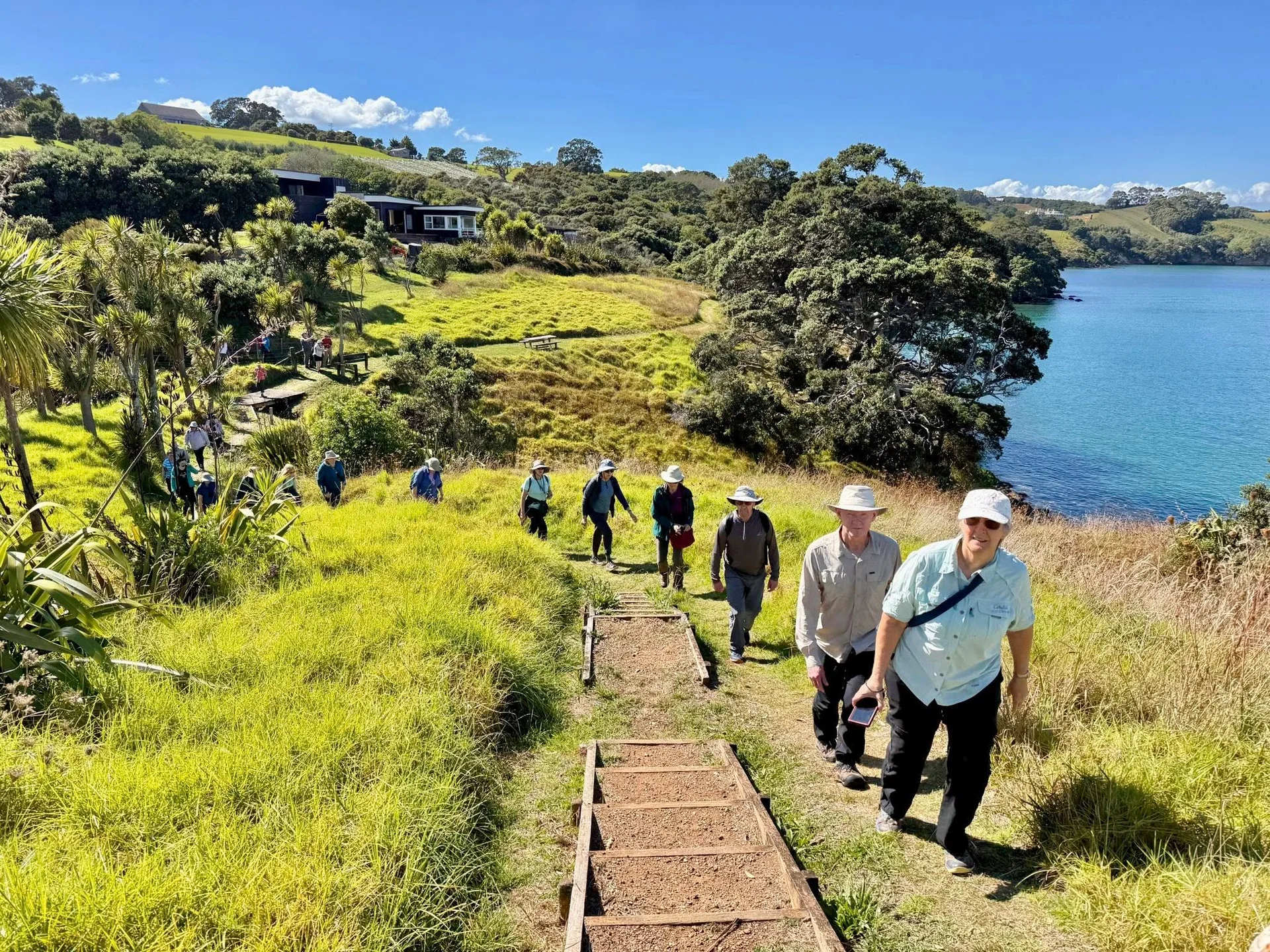
For walkers, what this means on the ground is simple. The islands are small, the coast paths are well-marked, and the rhythm of the day belongs to the tide.
The cliff paths around Jersey and Guernsey are well-graded and well-signed — built for walking, not scrambling.
What It’s Like to Walk Here
Jersey is the largest of the islands, about nine miles by five. The southern coast is sandy and flat — long bays where the tide pulls back so far that locals walk out to castles that, six hours earlier, sat in open water. Elizabeth Castle in St. Aubin’s Bay is one of those: at low tide, a paved causeway carries you across the seabed; at high tide, the same path is gone. You learn to read a tide table the way you read a weather forecast.
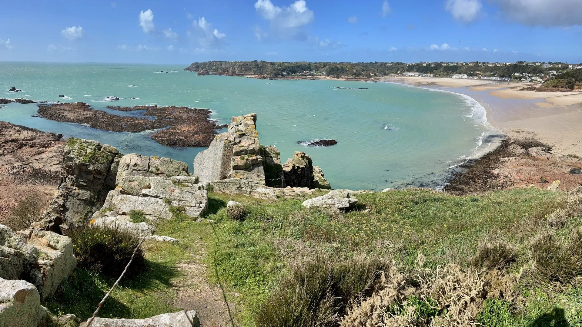
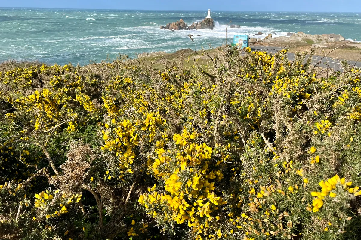
The northern coast of Jersey is a different walk altogether. Cliffs rise to two hundred feet and the path threads through gorse and bracken with the sea always to your right. There are stiles. There are kissing gates. There are short, breath-catching pulls up to a headland where someone has thoughtfully placed a bench. You can walk Bonne Nuit to Bouley Bay in a morning and finish it with crab sandwiches at a pub that has been pouring beer since the 1700s.
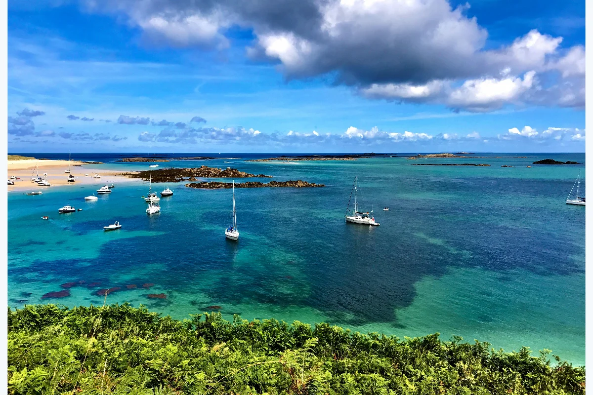
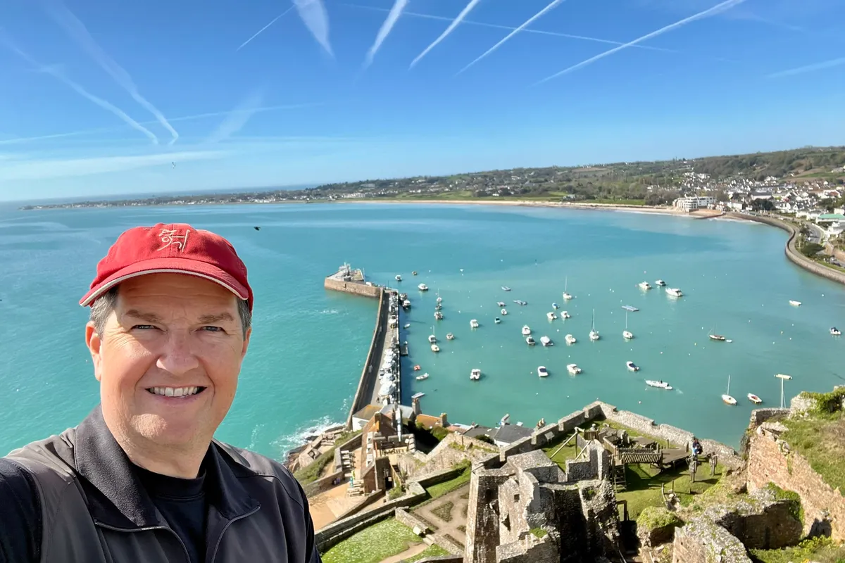
Guernsey, the second-largest island, has its own character. The cliff paths along the south coast — Icart Point, Saints Bay, Jerbourg — are some of the loveliest walking in the British Isles, and most travelers have never heard of them. The terrain is gentler than Cornwall, less crowded than the Lake District, and the views, on the right kind of day, are extraordinary.
Then there is Sark. Sark is three miles long, has no cars, and is reached by a small ferry from Guernsey. The whole island can be walked in a day, and on it, you can stand at the top of La Coupée — a narrow ridge of land joining Big Sark to Little Sark, with a sheer drop on either side — and feel, briefly, like you’ve walked off the map. Herm is smaller still. A mile and a half long, with one hotel, a few cottages, and Shell Beach: a stretch of white sand made entirely of broken seashells washed in by Gulf Stream currents.
The Tide Is the Schedule
The Channel Islands have one of the largest tidal ranges in the world. Forty feet between high and low water on a spring tide. That sounds abstract until you watch it happen. A bay that, at breakfast, holds a small fleet of dinghies tilted on their sides in the mud will, by lunch, be deep enough to swim in. Causeways disappear. Beaches double in size. A walk that was easy three hours ago is, at the wrong moment, cut off by water.
This is not a problem. It’s the point. Walking the Channel Islands means planning the day around the tide table the way you might plan a mountain day around afternoon thunderstorms. You go to Lihou Island (off Guernsey, reached by a causeway) when the water is out. You climb the steps at Plémont Bay before the tide comes back. The tide gives the day its rhythm, and the rhythm is slower than most modern travel.
The weather, too, asks for patience. The Channel Islands sit in the Gulf Stream, so they are warmer than you’d expect for their latitude — gardens grow camellias and hydrangeas and the occasional palm tree. But they are still in the English Channel, and the weather changes quickly. A morning of sun can give way to a fast band of rain by lunch and clear again by tea. You bring a layer. You bring a waterproof. You walk between the showers.
“The islands are small, the coast paths are well-marked, and the rhythm of the day belongs to the tide.”
A Complicated History, Read on Foot
The Channel Islands were the only part of the British Isles occupied by German forces in the Second World War. From 1940 to 1945, Jersey, Guernsey, Sark, Herm, and Alderney were under occupation, and the physical evidence is still there if you know where to look. Concrete observation towers, painted with grey-green camouflage that has weathered into the cliffs, watch the same sea they were built to watch. Underground hospitals, dug by forced labor, run for miles beneath the headlands. Some are open to visitors. They are quiet places to walk through.
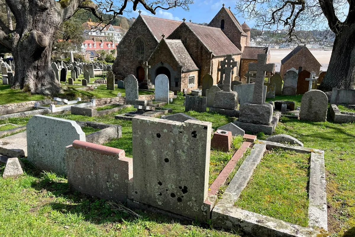
Older history is harder to see but easier to feel. The lanes between hedges in rural Jersey are sunken from a thousand years of cart traffic. The standing stones at La Hougue Bie predate the pyramids. The harbor at Saint Helier still has the same shape it had when ships sailed from it to Newfoundland for cod, and the same shape it had when the British fleet used it as a forward base against revolutionary France. You walk past it. You don’t need a guidebook open. The story is in the stones.
The dual Norman-English identity is everywhere. Street signs in Saint Helier are in English, but the island’s government is Les États de Jersey. Place names are French — Bonne Nuit, Trinité, Saint-Ouen — and pronounced the way a Jerseyman pronounces them, which is not quite the way a Parisian would. The food is a fair sketch of the geography: scallops and crab from the bay, Jersey Royal potatoes from the south slopes, beef and butter from the small dark-eyed cows that gave the island its name to the world.
Small harbors, small boats — the working coast hasn’t been turned into a postcard.
Who the Walking Suits
The Channel Islands aren’t mountain country. There are no long climbs, no scrambles, no exposed ridges. What there is, in good measure, is undulating coast path: short, repeated ups and downs along cliff edges, with occasional steps cut into the rock and the occasional muddy field after rain. The planned walks range from short harbor introductions to longer coastal days of roughly seven miles, with breaks built around tide windows and the next pub.
Walkers who enjoy the South West Coast Path in Cornwall, the Pembrokeshire coast in Wales, or the headland trails of the Aran Islands in Ireland will recognize the rhythm. The pace is honest. There is almost always a shorter route if a day looks long, and there is almost always a bench at the top.
WAI’s Channel Islands tour is rated Tour Pace 2 and Walk Challenge 3 — moderately active, with cliff paths that ask for sturdy boots but not for ambition. Group size is capped at 24. We base out of comfortable hotels on Jersey and Guernsey, take day boats to Sark and Herm, and walk roughly two to seven miles depending on the weather and the day. There is also an optional London extension after the tour, for travelers who want to layer in a few city days before heading home.
A Few Things Worth Knowing
- The Channel Islands are not in the UK or the EU. You may need to clear passport control on arrival even if you fly in from Britain. Bring your passport.
- The islands use the British pound, but Jersey and Guernsey each issue their own notes. Mainland UK shops won’t accept Channel Islands notes, so spend them before you leave.
- Mobile coverage can drop in and out along the cliff paths. Download offline maps before the day starts.
- Tide times matter. Plan around them. Your guides will, but it’s worth knowing why some days start early and others don’t.
- September is one of the best windows. The Gulf Stream keeps the water warm through autumn, the summer crowds have thinned, and the gorse and heather along the coast paths are at their richest.
Why We Walk Here
There is a kind of walking holiday that leans on big-name destinations — the Inca Trail, Mont Blanc, the Camino. The Channel Islands are not those places, and that is most of the reason we go. The trails are quiet because the islands are small and slightly difficult to reach. The history is dense because the geography forced it that way. The food is local because the islands are too small for a long supply chain. The weather is the weather, and you walk in it.
The pace, the size of the group, and the kind of day this gives you are why our travelers in their 60s and 70s tend to come back from the Channel Islands wanting to know what we walk next. It is not a trip you finish exhausted. It is a trip you finish wanting to know the names of the headlands.